


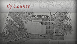


Stone County, Missouri


- Formed: February 1851
- County Population 1860: 2,384
- Slave Population 1860: 16
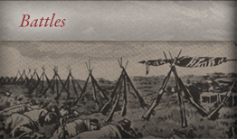
- Civil War Engagements
-Skirmish on the “Wire Road”
Image courtesy of Wilson’s Creek National Battlefield
Stone County, Missouri is located next to several sources of fresh water, including the White River. It also contains natural marble and lead deposits, and has naturally fertile soil suitable for growing corn and wheat. The Delaware Indians immigrated to this region about 1800 to 1808 and remained until their evacuation under governmental compulsion in 1830 to the Kansas Territory. These settlers generally came from Kentucky and Tennessee. In 1819, explorer Henry R. Schoolcraft traveled through the county. The 1830s and 1840s saw many immigrants to area. James Byrd, an early settler, opened the first grain mill, with many other mills soon to follow.
The county was officially formed in February, 1851, out of parts of Taney County, Missouri. It was named after William Stone, a veteran of the War of 1812 and prominent citizen of Taney County. Jamestown was named the county seat. It was later renamed Galena due to natural lead deposits in the area. Other towns, including Reeds Spring and Kimberling City, soon formed as well. Kimberling City was named after John Wesley Kimberling, who operated the Kimberling ferry. The ferry was the only way to cross the White River until the Kimberling Bridge was built.
The 1850s were a time of conflict in Stone County. Debates over whether Kansas should enter the Union as a slave or a free state dominated local debates, and several residents conducted raids back and forth to Kansas. Stone County had a very small slave population consisting of 16 slaves recorded in the 1860 Census. When the Civil War began in 1861, most men fought with the Union. Several small skirmished occurred in Stone County. On August 2, 1861, Confederate troops passed through Stone County on their way to Wilson’s Creek, with a minor skirmish taking place as they passed through. The “Wire Road,” originally called the “old Wilderness Road,” was completed in the early 1860s for the purposes of running telegraph lines. These lines and the road were very useful for communications during the war, especially for the Union. Therefore, Confederate troops targeted this road and cut many telegraph lines. In retaliation, Union troops burned one Confederate sympathizer’s home for every telegraph line cut. Another skirmish took place on the “Wire Road,” though the exact date it occurred was not recorded. A group of bushwhackers, a constant plague on the county during the war, fled from the Stone County Home Guard. The Bushwhackers were eventually overtaken and killed near a pond. Their bodies were never recovered, and today the pond is called “Ghost Pond.”
Several military regiments formed in Stone County. The Stone County Home Guard formed early on in the war to protect the residents from both armies. A local man, Cleimel Davis, served as Captain. Company K, 72nd Enrolled Missouri Militia and the 14th—later part of the 8th—Missouri Cavalry also formed. During the war, both armies harvested residents’ crops to feed the soldiers, forcing many residents to go hungry. The town of Blue Eye, on the Missouri-Arkansas border, was almost completely deserted during the war due to border warfare.
After the war’s conclusion, the railroad aided reconstruction in the area. Also, in the early 1880s, a local family discovered Marble Cave—later called Marvel Cave—and opened it to tourists traveling on the railroad. Eventually, Silver Dollar City, a popular entertainment park, was built around this cave.
 Browse all collections in Stone County
- Consulted:
- History of Stone County, Missouri, Vol.1. (Galena, MO: Stone County Historical Society, 1989).
- History of Stone County, Missouri, Vol.2. (Galena, MO: Stone County Historical Society, 1994).
- “The Early History of Stone County Missouri”, from The History of Stone County, Vol. 1, Galena, MO: Stone County Historical/Genealogical Society, 1989, accessed on 3 November 2010, http://www.rootsweb.ancestry.com/~mostone/misc/history.html
- Stone County, 1860 U.S. Federal Census – Slave Schedules [database on-line]. Provo, UT, USA: Ancestry.com Operations Inc, 2004. Original data: United States of America, Bureau of the Census. Eighth Census of the United States, 1860. Washington, D.C.: National Archives and Records Administration, 1860. M653, 1,438 rolls.