


Ozark County, Missouri


- Formed: January 29, 1841
- County Population 1860: 2,404
- Slave Population 1860: 43
Image courtesy of Wilson’s Creek National Battlefield
Ozark County is located on the Missouri-Arkansas border. It contains natural sources of fresh water, including North Fork River and Lick Creek. Wild game, including deer and turkey, are plentiful. Building stones like dolomite, limestone, and sandstone are abundant. The area also contains lead, copper, iron, and zinc deposits, as well as natural saltpeter for gunpowder manufacture.
Before white settlement, the Osage lived in the Ozark County, Missouri area. However, a treaty in 1808 caused them to move further west. Following the War of 1812, Kickapoo, Delaware, and Shawnee reservations were established in the county area, though they, too, were later moved westward.
Early settlers came from Virginia, Tennessee, and Kentucky. John Alsup and his wife Sarah were among the first settlers in the area. Early settlers survived by hunting wild game, harvesting other wild resources, such as honey, growing limited amounts of crops, including corn and squash, and participating in the fur trade.
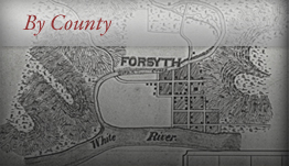
Ozark County was officially organized on January 29, 1841 out of parts of Taney and Wayne Counties. The name dates back to a French trading post that was located on a bend in the river. To find it, the traders stated that the post was “aux arcs,” or at the bend in the river. “Aux arcs” became “Ozarks,” which was the source of the name for Ozark County. Men from surrounding counties—John Wray, Jr. and William Phebus of Taney County and James Arnold of Greene County—named the county seat at Rockbridge. Rockbridge was settled in the 1830s and was the main population center at the time. In 1843, the legislature changed the county name to Decatur. County residents formed a petition and changed the name back to Ozark in 1845. In 1857, Douglas and Howell Counties were formed out of parts of Ozark County. Rockbridge was now too close to the Douglas County line to qualify as the county seat. In November, 1857, Josiah Wheat headed a commission to find a new county seat. Isaac Workman, a prominent resident, donated 50 acres of his land for the new county seat, which was named Gainesville after General Edmund Gaines, a hero of the War of 1812 and the Mexican War.
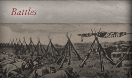
When the Civil War broke out in 1861, most residents remained loyal to the Union as there were very few slave owners in the county, only 43 slaves were reported in the 1860 Census. Missouri Governor Claiborne Jackson, a Confederate sympathizer, declared Confederate Brigadier General James H. McBride commander of Ozark and surrounding counties. Union sympathizers defied McBride’s orders and formed Home Guard units to protect the county residents. Ozark County’s situation as a border state with Arkansas caused many residents, about three quarters of the population, to flee. The county was sparsely populated along the river, leaving residents quite vulnerable to guerrilla attacks. Most moved to more densely populated areas. On their way to the Battle of Wilson’s Creek, Confederate troops invaded Ozark County, though Home Guard units fought them off. At the end of August, 1861, Confederate troops took control of the county. They accused prominent citizens Jesse James and a man named Brown of aiding Union troops. The men were hung for their supposed crimes.
There were no major battles in Ozark County boundaries, though skirmishes between troops and guerrillas were almost constant due to Ozark County’s situation as a border state. There was a small skirmish on the Douglas County line on March 6, 1862 between Confederate troops and Union troops under Captain Ludlow. Ozark County men fought in the Battle of Clark’s Mill in Douglas County and the Battle of Hartville in Wright County, Missouri in 1863. Ozark County men formed part of several military regiments in addition to the Home Guard units. These included: Company E, Missouri Cavalry under Captain Ludlow and Company F, 4th Missouri Cavalry under Captain Heiden. Members of the 16th regiment cavalry, Missouri volunteers, guarded the Missouri-Arkansas border. Members of Company I, 8th Missouri State Militia Cavalry, Company H, 46th Regiment Mississippi Infantry Volunteers, and a group of guerrillas fought in a large skirmish in Ozark County February 6-8, 1865.
The destruction resulting from the war in Ozark County was widespread. Despite an 1863 order authorizing the county records’ removal, the records were destroyed sometime during the war. The county was almost totally depopulated, and most of the homes, crops, and livestock were killed, burned, or otherwise destroyed. The only meat available to settlers that remained or who returned after the war was wild game, and there was no ammunition with which to hunt it with. Guerrilla warfare continued for some time after the war, as late as the 1870s. A drought in 1865 caused what crops that had survived destruction to fail. By the 1880s, residents finally began to recover from the war’s devastation. A successful milling industry began and residents began to grow cotton and raise beef and dairy cattle for profit. Tourism also began, as the Bull Shoal’s Dam formed the Bull Shoal’s Lake.
 Browse all collections in Ozark County
- Consulted:
- Shirley Carter Piland and Ruby Mateson Roberts, eds. A History of Ozark County: 1841-1991 (Gainesville, MO: Ozark County Genealogical and Historical Society, 1991).
- Ozark County, 1860 U.S. Federal Census – Slave Schedules [database on-line]. Provo, UT, USA: Ancestry.com Operations Inc, 2004. Original data: United States of America, Bureau of the Census. Eighth Census of the United States, 1860. Washington, D.C.: National Archives and Records Administration, 1860. M653, 1,438 rolls.