


Laclede County, Missouri


- Formed: February 24, 1849
- County Population 1860: 5,200
- Slave Population 1860: 305
Image courtesy of Wilson’s Creek National Battlefield
Laclede County, Missouri was traditionally Osage territory, but non-Native American settlers began to immigrate in the 1820s. The first settler was Jesse Ballew, who was first a resident of Pulaski County. Most settlers came from North Carolina, South Carolina, and Tennessee, including William Montgomery, William Tweedy, John B. Harrison, and William Hawkins. When Crawford County—one of Laclede’s parent counties—was created, the county seat was temporarily located at the home of John Harrison. Early settlers subsisted off of wild resources alone for several years, and traded furs in Jefferson City for salt and other goods. However, the wild animals and resources—wild lettuce, onions, plums, grapes, persimmons, cherries, walnuts, hazelnuts, butternuts, wild honey, deer, elk, bear, rabbit, and turkey—were soon depleted, and residents turned to small-scale agriculture. Soon, mills and businesses opened, with Jesse Brown and Berry Harrison opening the first of each, respectively.
Laclede County, Missouri is located on the Osage Fork of the Gasconade River and the Niangua River. These rivers have many tributaries, including the Dry Auglaize Creek, Mill Creek, and Panther Creek. The rivers provide fertile soil which is suitable for growing corn, oats, flax, hemp, and wheat. The area has natural hematite, lead, and zinc deposits, as well as dolomite, sandstone, and limestone which are excellent resources used in building.
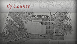
The county officially formed February 24, 1849 out of parts of Pulaski, Crawford, and Camden Counties. It was named after Pierre Laclede Liguest, a French fur trader and founder of St. Louis. Men from surrounding counties—including Thomas Whitmore of Miller County, John Duncan of Pulaski County, and Washington Henson of Dallas County—named the temporary county seat at the home of Colonel N. P. Murphy, a prominent resident, until a permanent site could be established. Citizens Benjamin B. Harris and James M. Appling donated a total of 50 acres for the county seat, which was named Lebanon after Reverend Benjamin Hooker’s home in Tennessee. Lebanon was founded on the site of Wyota, an old Osage village that was abandoned when the settlers began to arrive. By 1850, Laclede County’s population reached almost 2,500 people, and the population continued to grow in the years leading up to the Civil War. By 1860, the population was almost 5,200 people, with a slave population of 305 people.
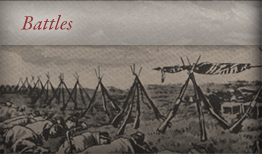
When the Civil War began, the majority of Laclede County residents sympathized with the Union, though the majority of the men who enlisted fought for the Confederacy. At this time, the county was very isolated from outside communications—about 100 miles from the nearest telegraph line—and residents were very surprised when Union troops under Captain Boyd and Captain Flag arrived in the early summer of 1861. The troops remained until the Battle of Wilson’s Creek in Greene County in August of that year. After the Confederate victory at Wilson’s Creek, the defeated Union troops again passed through Laclede County on their way to Rolla, and Confederate troops took control of Laclede County. On January 22, 1862, Union troops under General Samuel R. Curtis regained control of the county. The Union remained in control until the end of the war, and stockade the church in Lebanon as its headquarters.
Laclede County men fought in several military regiments. Most men enlisted with the Confederacy, and fought under Captain R.J. Wickersham, a local man. The men who fought for the Union were dispersed among many regiments. These included: Company G, 24th Missouri Volunteer Infantry under Captains James Talliaferro, Andrew W. Curry, and Charles Dalrymple, Company B, 8th Missouri Volunteer Cavalry under Captain Josephus G. Rich, Company H, 8th Missouri Volunteer Cavalry under Captain William Jones, Company I, 8th Missouri Volunteer Cavalry under Captain Levi P. McAdoo, Company G, 16th Missouri Volunteer Cavalry under Captain Samuel Turner, Company I, 16th Missouri Cavalry under Captain Charles Ruby, Company B, 46th Missouri Volunteer Infantry under Captain J.J. Hubbard, and Company A, 6th Missouri Volunteer Cavalry under Captain Theo A. Switzler. Many of these regiments took part in the Battle of Wilson’s Creek, the Battle of Carthage in Jasper County, the Battle of Cooper’s Mill, and the skirmish on Wet Glaize.
During the war, guerrilla warfare posed more of a threat than actual battles, as no major battles took place within Laclede County boundaries. Bushwhackers caused many prominent families to flee North or South, usually to Rolla or Arkansas, depending on their sympathies. Many of these families did not return after the war. Freeing slaves after the war did not cause much conflict, as slavery was never an important part of Laclede County’s economy. Businesses reopened—most ceased operations during the war—and railroad construction began in 1869. The railroad served as a catalyst for huge population growth, and by 1870 the population was almost 9,400 people.
 Browse all collections in Laclede County
- Consulted:
- http://www.usgennet.org/usa/mo/county/stlouis/laclede.htm
- History of Laclede, Camden, Dallas, Webster, Wright, Texas, Pulaski, Phelps, and Dent Counties. (Chicago: Goodspeed Publishing Company, 1971).
- Laclede County, Missouri: History and Families. Laclede County Genealogical Society. (Paducah, KY: Turner Publishing Company, 2000).
- Lois Roper Beard, The History of Laclede County, Missouri (Heritage Publishing Company, 1979).
- Frances Ethel Gleason, The First 100 Years (The Laclede County Centennial, Inc. 1949).
- Leo Nyberg, A History of Laclede County (Lebanon, MO: The Rustic Printers, 1926).
- Laclede County, 1860 U.S. Federal Census – Slave Schedules [database on-line]. Provo, UT, USA: Ancestry.com Operations Inc, 2004. Original data: United States of America, Bureau of the Census. Eighth Census of the United States, 1860. Washington, D.C.: National Archives and Records Administration, 1860. M653, 1,438 rolls.