


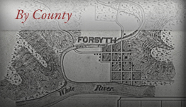


Cherokee County, Kansas


- Formed: February 1867
- County Population 1860: 1,501
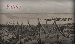
- Civil War Engagements
-The Battle and Massacre at Baxter Springs, October 6, 1863
-Quantrill’s Raid on Fort Blair, October 6, 1863
Image courtesy of Wichita State University Special Collections
McGee County, which contained all of what is now Cherokee County, Kansas, was formed by the Kansas Territorial Legislature in 1855, and named for E. McGee, a Congressman from Missouri who helped form the Kansas territory. McGee County contained a large portion of what were called the Cherokee Neutral Lands, or lands set aside solely for Cherokee settlement and reservations. The first settlers in the region, David M. Harlan, Richard Fields, George Fields, John Rogers, and Dennis Wott, arrived in the area from Georgia in 1835. They were members of the Cherokee Nation of mixed ancestry. They withdrew from the tribe, unhappy with the leadership, and came to the Cherokee Neutral Lands.
Attempts at white settlement in the Cherokee Neutral Lands began early on. The United States Army attempted to establish a military base in McGee County in 1842, but they later decided to move to Bourbon County and established Fort Scott instead. In the 1850s, against the wishes of and treaties with the Cherokee tribe, the government began to sell McGee County land to white settlers. John Appleby, J. Pickerell, and James F. Joy were among the first settlers in 1856. The area had large amounts of prairie land, suitable for grazing livestock, as well was abundant sources of fresh water including: The Spring River, Neosho River, as well as Lightning, Cherry, Four Mile, Tar, Shawnee, Cow, Short, and Bush Creeks. There are also numerous timber resources along the creeks. Settlers grew wheat, oats, rye, millet, sorghum, corn, castor beans, flax, timothy, potatoes, apples, pears, peaches, grapes, and cherries. Limestone and sandstone are plentiful, providing ready sources of building stone.
McGee County prospered quickly due to commercial lead and zinc mines that opened early in the county’s life. However, the county suffered from border raids, as with other counties in Kansas, with pro-slavery citizens in Missouri. Most of the McGee County residents had strong anti-slavery sentiments. When the Civil War broke out in1861, McGee County men fought in several Union regiments. These included: 2nd Kansas Colored Infantry, under Lieutenant Cook, Company D, 3rd Wisconsin Cavalry, under Lieutenant John Crites, and Company C, 3rd Wisconsin Cavalry, under Lieutenant Pond.
There was only one major military event in McGee County during the war. The Massacre at Baxter Springs took place on October 6, 1863, when William Clark Quantrill and his bushwhackers raided the county. Quantrill was heading south to Indian Territory for the winter. On their way there, they captured two Union scouts, who gave away the Union army’s position at Baxter Springs. Quantrill’s men attacked, and the Union Troops under Lieutenant Pond suffered terrible losses as they had been caught unaware. During the battle, Major General James G. Blunt and his body guard arrived. Quantrill’s men abandoned the battle on Lieutenant Pond’s troops and headed towards Blunt’s troops. Because Quantrill’s men wore Union uniforms, they were able to get close to the regiment. They killed the majority of Blunt’s troops. Those who were able to escape, Major General Blunt included, fled to Fort Scott in Bourbon County. Blunt was relieved of his command upon arrival.
McGee County residents suffered constantly from raids across the Missouri Kansas border during the war. However, after the war’s end, they recovered quickly due to commercial coal mines that opened in the area. In 1866, the Cherokee nation signed a treated ceding all of the Cherokee neutral lands to the United States. In February, 1867, McGee County was disbanded and Cherokee County, named for the Cherokee Neutral Lands, was organized in its place. Several townships were established, including Cherokee, Ross, Crawford, Garden, Spring Valley, Lola, Lowell, Lyon, Pleasant View, Mineral, Neosho, Salamanca, Shawnee, and Sheridan. The County seat moved several times, from Freepoint to Pleasant View to Baxter Springs in 1867 alone. In 1868, the county seat was permanently located at Columbus, named after Columbus, Ohio. Columbus became a prominent city, with several successful businesses including mills, banks, commercial lead and coal mines, and a beehive manufactory.
 Browse all collections in Cherokee County
- Consulted:
- http://skyways.lib.ks.us/counties/CK
- William G. Cutler, History of the State of Kansas (Chicago: A.T. Andreas, 1883) Accessed through:
- http://www.kancoll.org/books/cutler/cherokee/cherokee-co-p1.html
- Frank W. Blackman, Ed., Kansas: A Cyclopedia of State History, Embracing Events, Institutions, Industries, Counties, Cities, Towns, Prominent Persons, etc. (Standard Publishing Company, 1912) Accessed through:
- http://www.skyways.org.genweb/archives/1912/c/cherokee_county.html
- http://www.kansashistory.us/kscounties.html#McGee
- http://www.kansashistory.us/cherokee-ch13.html